
 US
Roadside edge AI for bridge strike warning
A bridge strike happens when a vehicle too tall for the clearance hits a low bridge, and the damage often closes the road or railway above it. A rugged computer on a pole or gantry watches the approach, recognizes a vehicle that will not fit under the bridge ahead and triggers a warning while the driver still has room to stop or divert.
A bridge strike happens when a vehicle taller than the clearance hits the bridge deck. Beyond the damage to the vehicle and load, the bridge has to be inspected before traffic, or trains on a railway bridge, can use it again. Height signs already mark low bridges; detection adds a warning aimed at the one vehicle that has missed them. The computers here come from our rugged Jetson computers, chosen for automotive camera inputs and a fanless design that runs outdoors all year.
Why a sign alone does not stop every bridge strike
- 01Drivers unsure of their height
- Hire vans, new vehicles and changed loads leave drivers without a clear idea of how tall they are today.
- 02Unfamiliar routes
- A driver following directions on a road they do not know may meet a low bridge with little warning.
- 03Static signs get missed
- A sign that is always there is easy to overlook; a warning triggered by your own vehicle is harder to ignore.
- 04Raised equipment
- Tipper bodies, cranes and loader arms left raised can make a vehicle taller than it was at the start of the journey.
From the approach road to the warning sign
Everything happens on the roadside computer, so the warning does not depend on a network connection.
-
Watch
GMSL2 camerasWeatherproof GMSL2 cameras on the approach stream video to the computer over long, locking automotive cables.
-
Detect
Edge AI on JetsonModels on the Jetson find and track each vehicle, often working with a laser or infrared height sensor wired to an isolated input.
-
Warn
Signs and lightsWhen a vehicle is over the limit, isolated outputs or a network command switch on flashing signs aimed at that driver.
-
Report
4G or 5GA short clip and alert go to the highway or rail control room over a cellular module, with the plate read by ALPR if required.
Jetson computers for the roadside
Two IP66 computers that mount outside on the pole or gantry, and a compact camera hub for sites with a roadside cabinet.
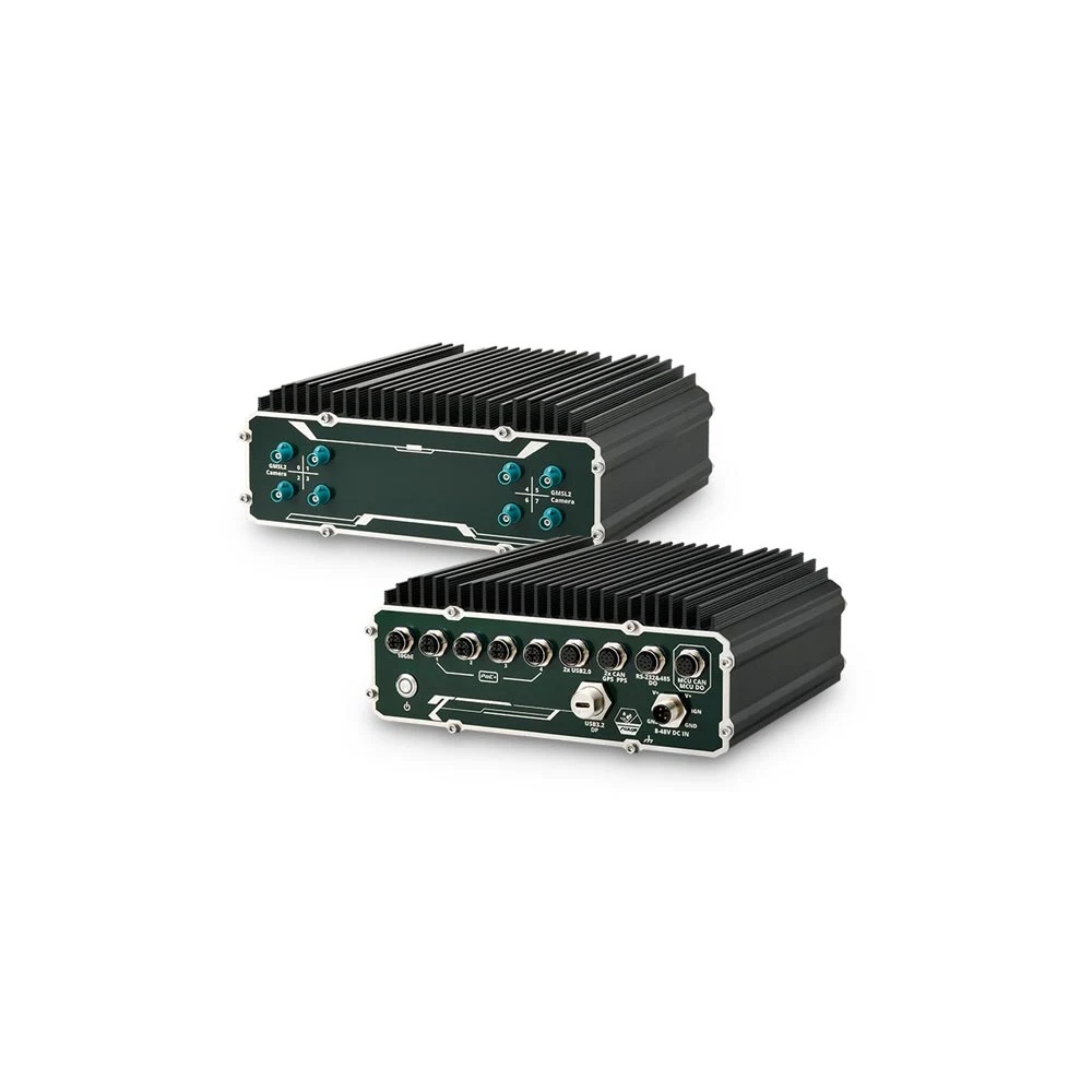
NVIDIA Jetson AGX Orin 32GB IP66 Outdoor Computer with 8x GMSL2 and 10GbE
- AI
- 200 TOPS
- SOM
- NVIDIA Jetson AGX Orin 32 GB
- Cameras
- 8× GMSL
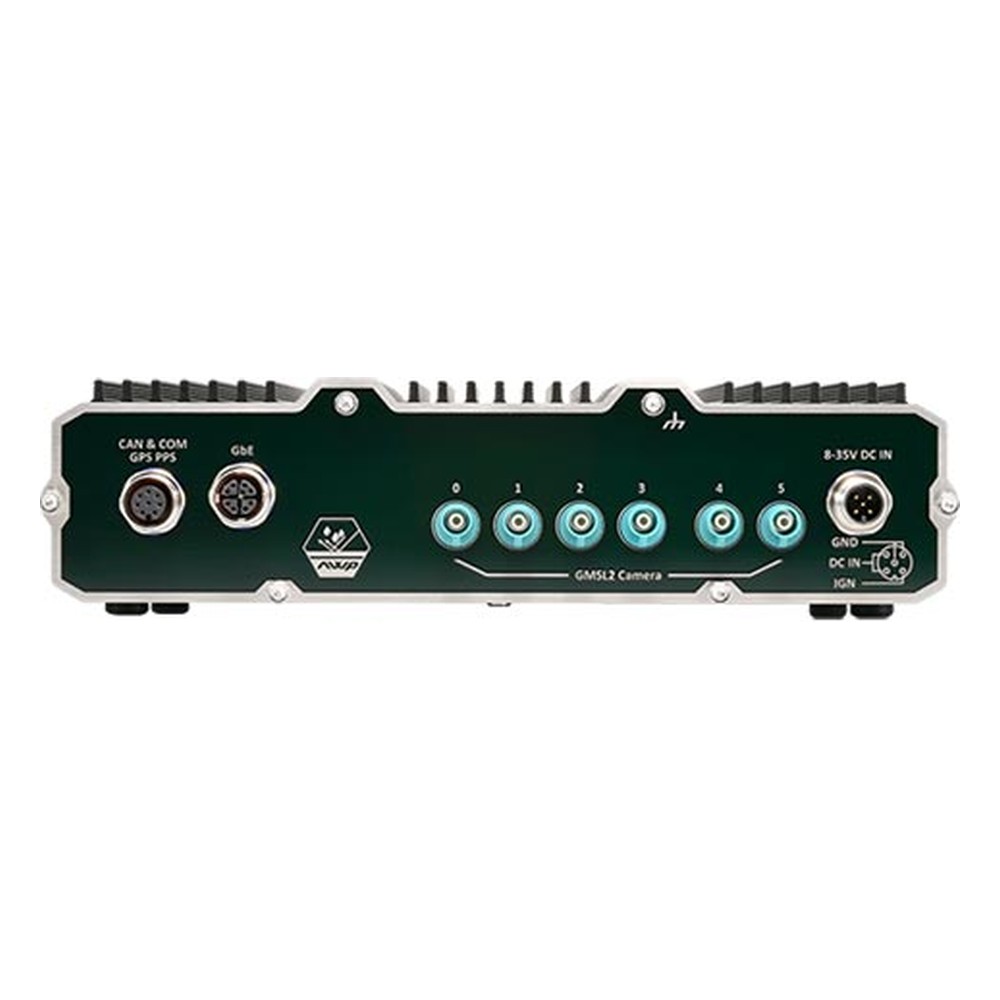
NVIDIA Jetson Orin NX or Orin Nano IP66 Waterproof Computer with 6x GMSL2 Cameras
- AI
- 20–100 TOPS
- SOM
- NVIDIA Jetson Orin NX 16 GB
- Cameras
- 6× GMSL
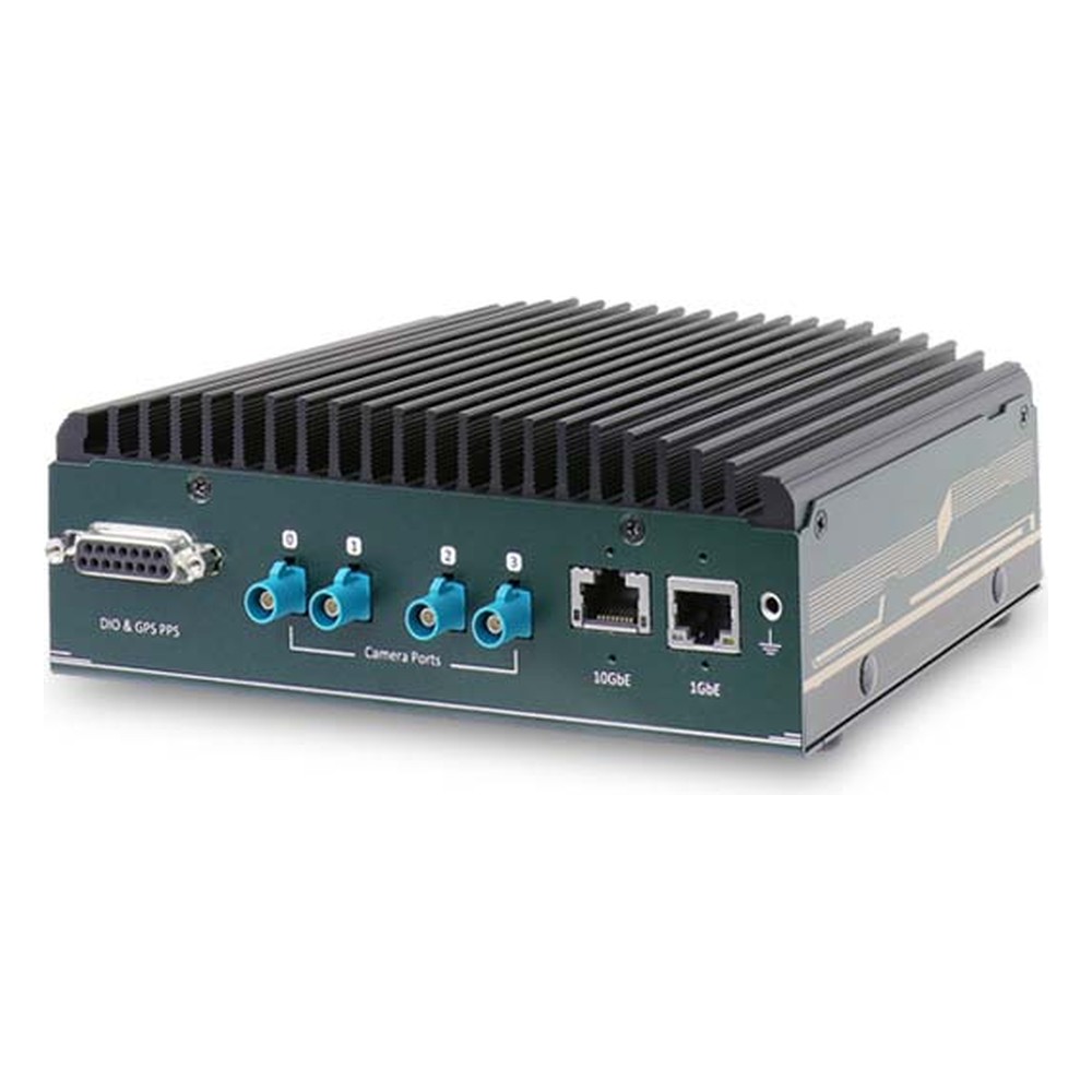
NVIDIA Jetson Orin NX or Orin Nano Rugged Embedded Computer with 4x GMSL2 Cameras and 10GbE
- AI
- 20–100 TOPS
- SOM
- NVIDIA Jetson Orin NX 16 GB
- Cameras
- 4× GMSL
Choosing a computer for the site
| Specification | Neousys NRU-230V-AWP-JAO32 | Neousys NRU-161V-AWP | Neousys NRU-51V+ |
|---|---|---|---|
| Mounting | Outdoors, on the pole or gantry | Outdoors, on the pole or gantry | Inside a roadside cabinet |
| Jetson module | Jetson AGX Orin 32GB, up to 200 TOPS | Jetson Orin NX or Orin Nano, up to 100 TOPS | Jetson Orin NX or Orin Nano, up to 100 TOPS |
| GMSL2 camera inputs | 8× FAKRA Z, waterproof | 6× FAKRA Z, waterproof | 4× FAKRA Z |
| Ethernet | 4× GbE PoE+ and 1× 10GbE, M12 | 1× GbE, M12 X-coded | 1× 10GbE and 1× GbE, RJ45 |
| Signal I/O | Isolated DIO (1 in, 2 out), 2× isolated CAN, RS-232, isolated RS-485, GPS PPS | CAN FD, RS-232, GPS PPS | Isolated DIO (3 in, 4 out), isolated CAN, RS-232/422/485, GPS PPS |
| Cellular | 4G or 5G, 2 SIM slots | 4G or 5G, 2 SIM slots | 4G or 5G, 2 SIM slots |
| Power | 8–48 V DC, M12 | 8–35 V DC, M12 | 8–35 V DC, terminal block |
| Operating temperature | −25 to 60 °C at full function; to 70 °C in 30 W mode without 10GbE or PoE load | −25 to 70 °C in 20 W mode; to 60 °C in MAXN | −25 to 60 °C in 15 W mode; to 70 °C with the optional fan kit |
| Ingress protection | IP66 | IP66 | Not sealed |
| Shock and vibration | MIL-STD-810H | MIL-STD-810H | MIL-STD-810H |
The NRU-230V-AWP suits a multi-lane approach with cameras on several lanes, a PoE+ height sensor or LiDAR, and outputs wired straight to the sign controller. The NRU-161V-AWP covers a smaller single-road site in a lighter sealed chassis. Where the site already has a ventilated cabinet, the NRU-51V+ gives four synchronized GMSL2 inputs and more isolated outputs in a compact case. For help choosing the module, see our Orin NX vs AGX Orin guide.
We supply each computer with JetPack installed and the camera drivers for the chosen GMSL2 cameras configured, fit the NVMe storage and the 4G or 5G module, and set up the digital outputs for the sign controller so the warning logic is ready to commission on site.
What this setup gives the highway operator
- 01A warning aimed at one vehicle
- Signs switch on only for the vehicle that is too tall, so drivers learn to take them seriously.
- 02Local decisions
- Detection and the trigger run on the roadside computer, so a lost cellular link does not stop the warning.
- 03Evidence for the control room
- Each alert arrives with video, so staff can see what happened and decide whether the bridge needs checking.
- 04No enclosure on the pole
- The IP66 computers mount directly outdoors with sealed camera and M12 connectors, keeping the roadside installation simple.
- 05Room to grow
- Spare camera inputs and network ports let the same computer take on other approach monitoring later.
Roadside edge AI FAQs
-
What Is GMSL2?
GMSL2 (Gigabit Multimedia Serial Link 2) is a high-speed serial link that carries uncompressed camera video, power and control data over one coaxial cable of up to around 15 meters. Developed for automotive cameras, it is now widely used on robots, autonomous machines and drones with NVIDIA Jetson computers.
-
What does IP66 mean?
IP66 is the rating above IP65 — dust-tight, and protected against powerful water jets. It is the standard specification for outdoor industrial computing in storm-exposed locations, marine deck equipment and light wash-down food handling, equivalent to NEMA 4 / 4X in North American markets.
-
What Is ALPR?
ALPR (automatic number plate recognition) is technology that reads vehicle number plates from camera images. A camera, usually with infrared lighting for night use, captures the vehicle; software finds the plate in the image and reads its characters; and the system checks the result against a list, such as permitted vehicles, payments or alerts.
-
What Is Video Analytics?
Video analytics is software that analyses video automatically to detect, classify and track people, vehicles and events, so operators do not have to watch every screen. Modern systems use AI models and often run at the edge, on a computer beside the cameras, to react in real time and avoid sending every stream to the cloud.
Planning roadside detection at a low bridge?
Tell us about the site, the cameras and the signs you need to drive, and we'll match the Jetson computer, camera inputs and I/O to the approach.